/prod01/prodbucket01/media/durham-university/departments-/geography/Matt_Couchmann-3872X1296.JPG)
Scales of morphological change in a gravel-bed river
Project overview
The forces require to entrain sediment grains from a riverbed depend on grain size and how those grains are arranged (e.g. grain protrusion). Grain protrusion has not been widely used as a measure of sediment mobility because it is difficult to measure, but new methods such as G3Point (Steer, Laurit et al., 2022) enable both grain size and arrangement to be measured from high-resolution terrestrial laser scan (TLS) data of gravel surfaces. This project will apply these new methods to TLS data which has been collected over multiple years from Bury Green Brook, a small gravel-bed river with a riffle-pool morphology. The aim of this project is to identify reach-scale patterns of morphological change over multiple years, and to see whether they are linked to grain-scale changes in sediment size and arrangement. As the TLS data have already been collected this will be a desk-based project, but there may be opportunity to collect some pilot data for method testing.
If you are interested in this project, please contact the lead supervisor: Prof. Rebecca Hodge (rebecca.hodge@durham.ac.uk)
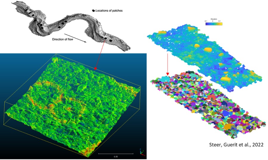
Key references
Hodge RA, Sear DA, Leyland J. 2013. Spatial variations in surface sediment structure in riffle–pool sequences: a preliminary test of the Differential Sediment Entrainment Hypothesis (DSEH). Earth Surface Processes and Landforms 38 : 449–465. DOI: 10.1002/esp.3290
Steer P, Guerit L, Lague D, Crave A, Gourdon A. 2022. Size, shape and orientation matter: fast and semi-automatic measurement of grain geometries from 3D point clouds. Earth Surface Dynamics 10 : 1211–1232. DOI: 10.5194/esurf-10-1211-2022