Roger Searle’s Home Page
R. C. Searle
Professor of Geophysics (Emeritus)
Department of Earth Sciences
Durham University
Durham DH1 3LE, UK
Phone +44 (0) 191 33 42307
Fax +44 (0) 191 33 42301
Email [email protected]
Professor of Geophysics since 1989 (Emeritus since 2010). Researches in marine geophysics, especially tectonic and magmatic processes at mid-ocean ridges. Over 130 publications in peer-reviewed journals.
Major text book:
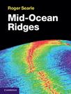
Mid-Ocean Ridges
Published 2013
Cambridge University Press
ISBN-10:1107017521
www.cambridge.org/9781107017528
Links